Technology for Wildlife Foundation - Updates Thread

About us

Hello to the readers and members of the Grove Forum. This is the first Grove update from Technology for Wildlife Foundation (TfW), and we’ll update this thread periodically with more news about our projects and activities.

At TfW, our mission is to amplify conservation impact through the use of appropriate technology. Our work is mediated by our experience, extensive research and inclusive stakeholder consultations. We have domain expertise in geospatial analysis and robot operations, and conduct both our own projects as well as collaborative projects with individuals and other organisations. As of June 2021, we are a registered not-for-profit organisation (a Section-8 company) based out of Goa, India

  1. Overall updates (since the last update)

We welcomed new team members to the Foundation in November and December 2021. Our current core team of 4 is made up of a conservation cartographer and a conservation communicator who work closely with our programme manager and director.

Our on-going independent initiatives are a) the Clearance Mapper, b) the UAV for Conservation in India, c) the Ghost Gear Technology Project and d) the Reimagining Coasts Initiative ( a joint venture with Eco-Niche). We’ve provided a little more information on these projects further below.

Our collaborative projects are with conservation journalism organisations and with NGOs. For the first, we’re currently collaborating with Mongabay-India to produce maps of various kinds to accompany articles on wildlife and environmental conservation. With NGOs, we currently have on-going projects with Dakshin Foundation, WWF-India and the Wildlife Conservation Trust (WCT), among others. We recently completed the first of two field trips to Bihar, with WCT, where we used UAVs to study Gangetic dolphins and gharials.

  1. Progress on the goals listed while on-boarding

Our goals for the 2021-24 period are to collaborate, innovate and educate. To meet these goals, we’re developing projects in collaboration with our partners and conducting our own independent technology projects that will assist the larger ecosystem of conservation practitioners. To promote the effective use of technology for conservation, we’re giving talks and seminars, conducting workshops, writing blog posts and participating in panel discussions.

A sample of our recent talks:

  1. A workshop on the use of robots for conservation, for ENVIS/WWF-India’s 2022 cohort of the Green Skill Development Programme.
  2. An invited talk on Technology for Wildlife Foundation’s work at the Outlook India Responsible Tourism Awards 2022, held in Hampi, Karnataka.
  3. A panel discussion at the International Congress for Conservation Biodiversity (ICCB) on the role of conservation science in the 21st Century

Aside from our various collaborative projects, we’ve also initiated our own, which are designed to assist the larger conservation community in India.

Independent Initiatives

a) Clearance Mapper Project

We are building expertise in using PARIVESH (www.parivesh.nic.in), the government portal that provides information on forest, wildlife and environment clearances provided by the government to development projects around the country. We are also making clearance data more accessible to the general public in two ways; firstly, we are putting out educational material on how this data can be used for conservation purposes, and secondly, we are working towards creating tools which allow for easier access and analysis of this data. More information is available in this blogpost

b) UAVs for Conservation in India

We are creating a report documenting the use of UAVs for conservation purposes in India over the past few years. Interviews are being conducted with conservation practitioners and UAV operators across the country, and we’re collecting a very interesting set of use cases that will be published in the public domain. Shivali Pai, a researcher at the Liverpool John Moores University in the UK, is working with us on this project.

c) Ghost Gear Technology Project

In June 2019 we completed a report on the use of technology to locate abandoned, lost and otherwise discarded fishing gear, commonly known as ghost gear. We re-opened this project in September 2021, and are currently in the process of updating our research and preparing a manuscript for publication in a peer-reviewed journal. Our intention is for this paper to assist with the mapping of target areas for ghost gear removal, thus reducing the threat to marine wildlife. Dr. Meredith Palmer joined us as a research consultant on this project in November 2021.

d) Reimagining Coasts Initiative

The goal of this initiative is to create a financially sustainable coastal conservation model that leverages modern technology and the nascent ecosystem-services market.

This initiative comprises research and innovation that inform collaborations and conservation strategy. We are analysing data acquired from UAVs and satellite imagery to rapidly and accurately assess ecosystem services provided by mangrove forests and seagrass beds. We’ve put together project designs for work in Goa, and have also initiated collaborations with Panchabhuta Foundation (Karnataka), Farmers For Forests (Maharashtra) and with Praja Pragathi Seva Sangham (Andhra Pradesh).

  1. Any challenges

The third wave of the Covid-19 pandemic in January 2022 delayed both field work as well as our search for a permanent office space in Panjim, Goa. Conversely, the open window for travel in March and April 2022 has led to a high demand for our services, which has led to a heavy workload for our team. We are managing this by prioritising urgent tasks, and are making full use of GSuite, Slack and Asana to work efficiently.

With our growing team, managing payroll and compliance were also becoming more complex. Thanks to assistance from Tech4Good Community, we were able to connect with Razorpay and are now enthusiastic users of the Razorpay HR & Payroll toolkit.

  1. Any new avenues of collaboration (with other Grantees of RCF or other NPO/NGO)

Under our Reimagining Coasts Initiative, we are collaborating with fellow RCF grantee - Farmers for Forests by working with their forest protection and mangrove reforestation pilot study in Raigad.

We are also working with Dakshin Foundation on developing methods to effectively use UAVs for turtle conservation in Odisha.

  1. Highlights from the initiatives being undertaken as part of your organization

**We’ve been assisting the #SaveMollem campaign with spatial analysis support. The campaign as a whole was awarded the Sanctuary Wildlife Service Award 2021 at the Sanctuary Asia Awards.

In 2021, our Reimagining Coasts Initiative was selected to join the Land Accelerator Asia by the World Resources Institute.

Also in 2021, Technology for Wildlife Foundation was selected as an ESRI Conservation Program grantee.

At the Outlook India Responsible Tourism Awards 2022, Technology for Wildlife Foundation was recognised as ‘One to Watch’ in the Sustainable Conservation Leadership category. This award was handed over to Shashank Srinivasan by the Karnataka Minister of State for Tourism, Ecology and Environment.

Also in 2022, we have been nominated for an AirWard in the Survey and Inspection category.

  1. Outcomes you are chasing for the next 6 months (these can remain the same if unchanged since the last update)

We will complete and publish our work on both Ghost Gear Technology and the Use of UAVs for Conservation in the next six months. We also hope to make significant progress on our Clearance Mapper project, with the development of a usable tool. Our collaborations are proceeding apace; we will be revisiting the Gandak river after the monsoon is complete to conduct the second phase of our dolphin and gharial surveys in collaboration with the Wildlife Conservation Trust. As part of this project, we’ll be initiating a collaboration with IISER-Bhopal to use computer vision to identify the target species in UAV imagery. We also hope to be able to work in Ladakh later this year, on marmot and pika surveys, and in Odisha, on olive ridley turtle surveys.

  1. KPIs (please use this section to let us know of the impact and reach of your work since the last update)

This is our first update!

  1. Can Rainmatter be of help with anything at all

We’re looking for assistance on data architecture for our Clearance Mapper platform. While we have narrowed down on Amazon Web Services, technical advice on how best to set up our code and database would be very helpful.

  1. Any additional details you would like to provide

We blog extensively about our work at www.techforwildlife.com/blog, and are also very active on Twitter and Instagram (@techforwildlife).

  1. Please also share any images or videos that you have documented as part of your work


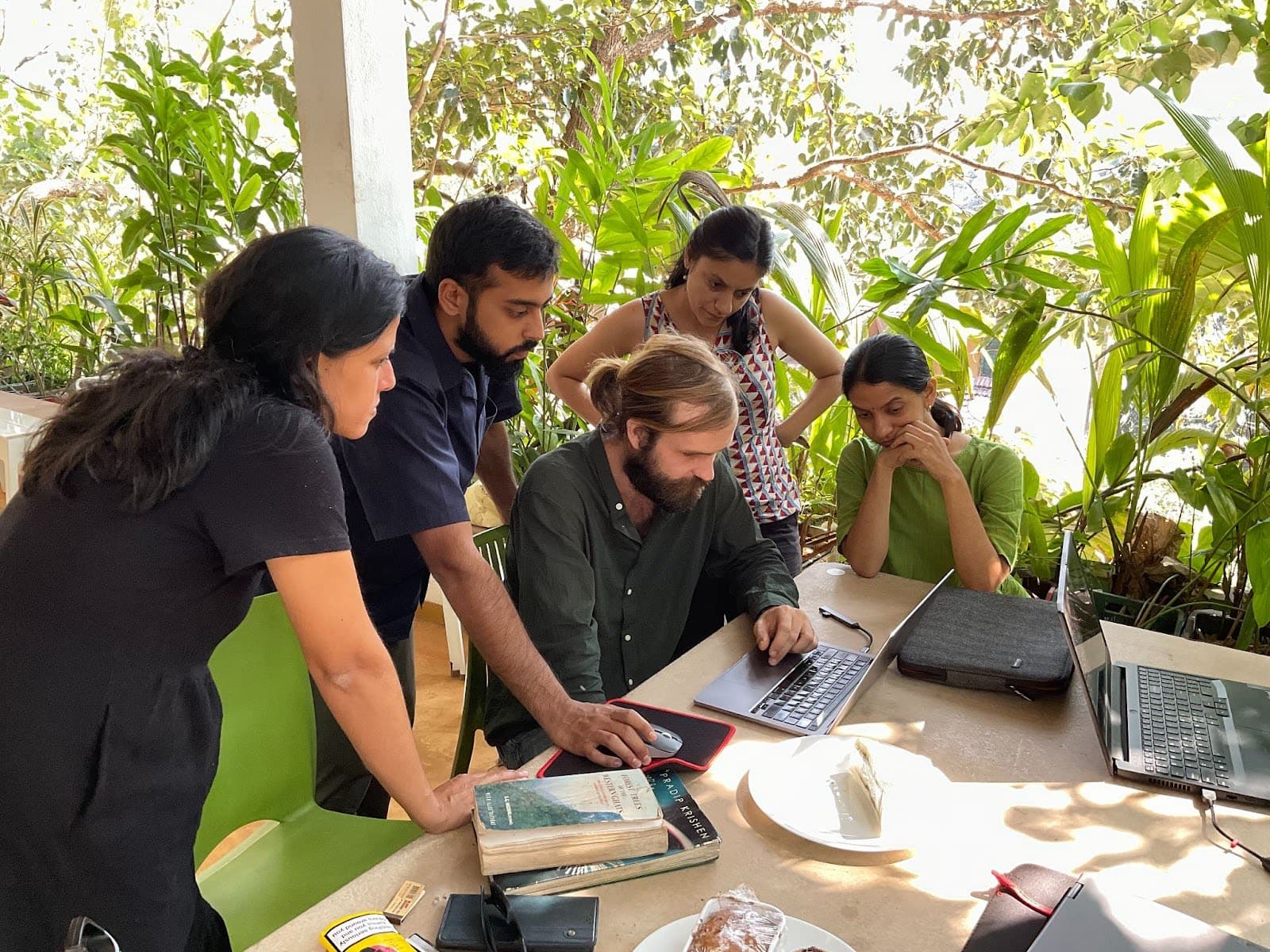
A Technology for Wildlife Foundation team selfie (as of April 2022)

6 Likes

Hello to the readers and members of the Grove Forum!

This is the second Grove update from Technology for Wildlife Foundation.

1) Overall updates

We welcomed a new member to the Foundation’s team in June 2022. Our current core team of five comprises two conservation cartographers, a conservation communicator, a programme manager and the director. In this phase of the post-pandemic era, our team has transitioned from fully remote to a hybrid model in Panjim, Goa. We meet to work together as required, and work from home, cafes or co-working spaces otherwise. While we are currently looking for a permanent office space in Panjim, we will continue working in this hybrid mode for the near future.

Two of our team were selected to attend fellowships and workshops during the monsoon, when most of our fieldwork was restricted. Nandini Mehrotra, our programme manager, was in Bellingham, Washington, U.S. as a Kinship Conservation Fellow, while Nancy Alice, our conservation communicator, attended the Bangalore Science Gallery’s Carbon School.

In August, we met the Mongabay-India team in person when they visited Goa, and had a full-day meeting with them regarding our collaboration on conservation cartography.

In September, once everyone returned to Panjim, we had a two-day in-person meeting; on the first day, we recapped each team members’ work and experience over the summer, and on the second, we discussed carbon, carbon markets and carbon-centric spatial analysis with Nisha D’Souza from EcoNiche sitting in.

Also in September, TfW was invited to co-lead India Flying Labs, and is currently the nodal organisation for any Indian UAV/conservation project that arises from the network. In practice, this gives us more visibility, and more access to projects of the type that we specialise in.

After a year of experience, we’ve locked in our operational technology stack for the foreseeable future. Our primary tools are GSuite, Asana and Slack for day-to-day operations, and RazorpayX for pPayroll & HR. Via Razorpay and Plum, we have comprehensive group health insurance for all full-time staff.

2) Progress on the goals listed while on-boarding

Our current on-going independent initiatives are (a) the Clearance Mapper, (b) the use of UAVs for Conservation in India, (c) the Ghost Gear Technology Project and (d) the Reimagining Coasts Initiative (a joint venture with Eco-Niche). A new addition to this list is (e) a QGIS plugin to help plan conservation-related UAV mapping missions. We’ve also summarised a set of our other activities under f) Minor on-going projects and outreach.

a) Clearance Mapper Project

In August 2022, from an outreach perspective, we authored an article in Sanctuary Asia on PARIVESH, along with advantages and disadvantages of the portal.

Regarding constructing the clearance mapper tool itself, we spoke to various lawyers and understood that unless the data hosted on PARIVESH was released under an open–source licence, we would incur significant risk by making the data itself available to the general public. However, we use the tools we’ve built as required by our projects, and are working towards making the code that underpins these tools publicly available.

b) UAVs for Conservation in India

We are preparing a report that documents the use of UAVs for conservation in India. Our current collaborator on this project is Shivali Pai, a researcher at the Liverpool John Moores University in the UK. Together, we have interviewed conservation practitioners and UAV operators across the country, and will be conducting more interviews over the next few weeks. Our goal is to have Volume 1 of this report published early next year. Our planned Volume 2 will extend to UAV operations across South Asia, South-East Asia and Africa.

c) Ghost Gear Technology Project

Our paper on the use of technology to find and identify ghost gear has been updated; it now lists more types of technology and is applicable globally. It is now applicable globally, and comprehensively covers the various types of technology available. The draft is currently in the final stage, after which we will submit it for peer-review and eventual publication. Our collaborator on this project is Dr. Meredith Palmer, a conservation technology specialist with Fauna and Flora International (FFI).

d) Reimagining Coasts Initiative

In May, we made a field trip to Raigad, Maharashtra with Farmers for Forests (F4F), a fellow Rainmatter grantee, to assess mangrove restoration sites. We deployed UAVs to scout for potential sites, and collect data that would support decision-making on whether particular sites could host viable sites.

We’ve also been working towards understanding the mangrove/carbon space, from both the research and the market perspectives. We’ve spoken to numerous actors in this space, and are in the process of actively developing projects that will assist with mangrove conservation and restoration across India.

e) Open-source UAV mapping plugin

We’ve created the first version of an open source QGIS plugin that streamlines the production of UAV mapping missions. This combines some of our previous work on a drone image calculator, along with some geospatial operations, and is now publicly available in the QGIS plugin repository.

f) Minor on-going projects and outreach.

  1. We maintain a Pinterest board (https://pin.it/4DWD1gP) where our work on conservation cartography is publicly available.
  2. We continue to write on our processes and projects on our organisation blog.
  3. We produced and play-tested a game depicting the spatial components of human-elephant conflict at ATREE’s 25th Anniversary event.
  4. We continue to present our work using technology for conservation at webinars and in live seminars.
    (i) On conservation cartography in Goa and on our spatial analysis-support for the #SaveMollem campaign at the Liberty & Light Festival in Goa (May 2022).
    (ii) On informing and amplifying use of tech in conservation webinar hosted by the Rainmatter Foundation (June 2022).
    (iii) On the use of technology in conservation practice and innovation at the Engineering for Change (E4C) webinar (October 2022).
    (iv) We’ll be participating in a panel discussion at the Wildscreen Festival in Bangalore on the 22nd of October 2022.

3) Any challenges

We were unable to execute our joint project in Odisha with WWF-India and Dakshin Foundation, on the use of UAVs for Olive ridley turtle conservation, as the Odisha Forest Department did not issue the necessary approvals. We’ll attempt this project again in the next field season.

Regulatory compliance continues to be an administrative burden. We recently switched accountants/auditors, and in combination with Razorpay’s tools, this has reduced the time and effort required for administrative activities.

4) Any new avenues of collaboration (with other Grantees of RCF or other NPO/NGO)

In June, we ran an ODK capacity building workshop for a Sanctuary Asia’s Mud on Boots grantee working on sacred grove conservation. We also produced a map of global killer whale distribution that for Current Conservation, published in Issue 16.2 in August 2022.

In July, in collaboration with researchers from Florida International University, we prepared a map describing the location where a sleeper shark discovered in the western Caribbean. This research paper, including our map, was published in Marine Biology.

In August, The Habitats Trust (THT) and TfW undertook a field trip to Pondicherry to test the usability of ROVs for the survey and data acquisition on coral reefs on Indian coasts.

In September, we used UAVs to map a lake in Bangalore, followed by an online discussion on the use of of UAVs for lake conservation in Bangalore, for Paani.Earth. We also created maps for the Goa Foundation that depict the highway expansion through Mollem National Park; these were submitted in court.

In October, we conducted high-altitude UAV mapping missions in Ladakh in collaboration with IISER-Tirupati’s Scuirid Lab. The objective of this project was to assess whether UAVs could effectively map the habitat and population distribution of marmots and pikas. This is an on-going collaboration. We provided WWF-India with remote support regarding the use of drones in Bihar, to help them locate a designated man-eating tiger.

We have an on-going collaboration with IISER-Bhopal on the use of computer vision for wildlife detection in UAV imagery and video. Our on-going collaboration with Mongabay-India on conservation cartography continues, as does our work with the Wildlife Conservation Trust on dolphin and gharial conservation.

We’ve been in discussions with Fields of View regarding the production of games that help build public awareness regarding conservation trade-offs, and are at the project design stage currently.

5) Highlights from the initiatives being undertaken as part of your organisation

The National Green Tribunal (NGT) has stayed all further construction on the road connecting to Honnavar Port in Uttara Kannada. Mongabay-India’s three-part investigative reporting of environmental norms & the community rights being ignored for the project. TfW contributed to the stories by visualising the areas of impact and misattribution; we’ve been privately informed that our maps were very useful in court.

The Supreme Court’s decisions in April and May on the linear infrastructure projects through Mollem National Park validated our work with the Goa Foundation and the SaveMollem campaign.

Our work using Planet satellite data for monitoring land use change near coastal mangrove and forest ecosystems under the NICFI Program was mentioned on global advancements in science and protected forests.

6) Outcomes you are chasing for the next 6 months (these can remain the same if unchanged since the last update)

We aim to complete our Ghost Gear and Use of UAVs for Conservation projects in the next few weeks. We have usable tools in place for our Clearance Mapper project; as our understanding of the risk environment improves, we will aim to make these tools publicly available. We’ve successfully completed the marmot/pika surveys in Ladakh, and hope to be able to conduct our planned turtle surveys in Odisha in the next 6 months.

7) KPIs (please use this section to let us know of the impact and reach of your work since the last update)

Since our last update, we have new collaborators and projects, as well as many more in development. We plan to conduct an impact assessment of our work over the next year, which we will share in a subsequent update.

8) Can Rainmatter be of help with anything at all

We are now attempting to create a cloud-based media library, that will host all our media in an accessible format. The tech-solution here seems to be to use Amazon Web Services, and Rainmatter’s technical guidance would be useful in this regard.

9) Any additional details you would like to provide

We blog extensively about our work and are also very active on both Twitter and Instagram (@techforwildlife).

10) Please also share any images or videos that you have documented as part of your work

Underwater footage from our recent fieldwork off the coast of Pondicherry, using a remotely operated vehicle to explore deep marine wildlife habitats, is available on Twitter here:

3 Likes

Absolutely delighted by the updates, thanks much Shashank, and kudos to the entire team!

1 Like

Hello to the readers and members of the Grove Forum!

This is the third Grove update from Technology for Wildlife Foundation, with a brief summary of our activities since our last update.

Our team has recently completed some intensive travel. After two field trips and a couple of conferences, we are now back at deskwork over the hot summer months of April and May. Data analysis, reporting and planning are our current foci, alongside our continued conservation technology consulting role to practitioners in the sector.

Following on from our field trip to Ladakh in October to conduct marmot and pika surveys, we are now working on computer vision techniques to automatically identify burrows, and their exact coordinates, from UAV video.

In November 2022, we undertook a brief excursion to Divar Island in Goa to experience the local mangroves, and practice UAV operations… We also conducted a field trip to North Goa with The Good Ocean, using UAVs to gather baseline data on seaweed growth and potential harvesting sites along the coast.

In December 2022, the entire team came together for our last full team meeting of the year. We discussed our projects and our progress, and identified any remaining tasks that needed to be completed before the end of the year. A blogpost on TfW’s highlights for 2022 was published on our website as well.

We completed the first phase of our counter-mapping work with our collaborators for NID Ahmedabad, which will continue through 2023.

In January 2023, we began the year with an in-person team meeting where we discussed our objectives and goals for the first quarter. Our first field trip of the year was to Mollem, where we inspected various linear infrastructure features that affect the park.

In mid-January, we visited our collaborators Alex and Kristina near Mhadei Wildlife Sanctuary in Goa, to assist them with their forest restoration work using our UAVs. We obtained aerial views of the land plots they are working on, enabling them to identify potential areas for passive forest restoration and prioritise work areas. Separately, we were invited to meet with the Chief Warden of the Goa Forest Department, along with representatives from Goa’s Marine Stranding Group, to provide them with inputs on olive ridley turtle conservation in Goa. Towards the end of January, we met with three separate groups of academics at BITS Pilani-Goa to discuss potential future collaborative work around the use of UAVs and remote sensing for conservation.

In February, we attended the Fifth Central Indian Landscape Symposium at Kanha, hosted by Conserving Central India, where we discussed the conservation challenges in the region with stakeholders. Also in February, we completed our second field trip to Bihar with the Wildlife Conservation Trust, India (WCT), where we conducted aerial surveys of Gangetic river dolphin and gharial populations . At the end of the field period, both organisations conducted a day-long training workshop for the Bihar Forest Department on river-floodplain wildlife conservation.

In March, we travelled to Odisha for field work to assess the feasibility of using drones for studying near-shore olive ridley turtle aggregations, as part of a three-way collaboration with WWF-India and Dakshin Foundation. We gathered aerial video-transects of near-shore turtle aggregations, and generated orthomosaic maps of nesting beaches. All the data from this fieldtrip has been processed, and we’re currently working on using computer vision techniques to assist with counting turtles.

Since the projects through Mollem were proposed in early 2020, we have been working to understand, and alleviate, their potential impact. In March, we created a story map that outlines the history of these three projects, to increase public awareness about this issue.

During the first weeks of March, Goa’s Western Ghats had a set of intense fires. We developed a set of burn scar maps to identify impacted forest areas to inform future restoration projects. We conducted internal capacity building workshops on the use of vector design tools for cartography, and refined our spatial analysis workflow.

Our current on-going independent initiatives are (a) the Clearance Mapper, (b) the use of UAVs for Conservation in India, (c) the Ghost Gear Technology Project and (d) the Reimagining Coasts Initiative.

a) Clearance Mapper Project

In August 2022, we authored an article in Sanctuary Asia on using government data to monitor infrastructure projects that may impact wildlife habitat. We have built tools that allow us to effectively analyse data from numerous sources, and are now working towards building queryable databases using cutting-edge Large Language Model technology.

b) UAVs for Conservation in India

Our comprehensive report on the use of UAVs for conservation in India is almost complete, and will be published by the end of May 2023. Our work on this project has involved conducting interviews with conservation practitioners and UAV operators throughout the country.

c) Ghost Gear Technology Project

Our paper on the use of technology to detect ghost gear is almost ready for publication, and will be submitted for peer-review in the next few weeks.

d) Reimagining Coasts Initiative

Based on our experience, our Reimagining Coasts Initiative has pivoted from research to praxis, with an increased focus on developing methods to effectively use UAVs to assist with mangrove conservation and restoration. This ties in with our ongoing restoration assistance program.

e) Minor on-going projects and outreach.

  1. Conservation Optimism India interviewed Shashank Srinivasan about his journey in conservation and on founding TfW (Oct 2022).
  2. We spoke to students on the use of technology for conservation at Ganpat Parsekar College, Arambol as part of a state-level workshop supported by the Directorate of Higher Education, Goa (Jan 2023)
  3. We participated in the inaugural meeting of the Goa Development Group at the Goa Institute of Management’s seminar on Goa’s economy and society, where we made a presentation on the potential impacts of the infrastructure projects planned in Mollem (Jan 2023).
  4. We mentored students at Srishti Institute of Art, Design and Technology for a studio on environmental design (Jan 2023).
  5. We were part of a round-table presentation on use of technology for conservation in the Fifth Central Indian Landscape Symposium at Kanha, where practitioners in the region gathered to discuss conservation issues. Programme Manager, Nandini Mehrotra hosted an interactive session on the use of technology for wildlife and environment conservation (Feb 2023).
  6. As part of our training workshop for the Bihar FD’s frontline forest staff, on ‘Monitoring threats to river-floodplain wildlife in the Gandak river’ we spoke to them about our work on using technology for conservation. We also carried out a learning session on using open-source tools, and conducted hands-on training on using UAVs in the field (Feb 2023).
  7. We provided a guest lecture on our work and the use of technology for mangrove conservation to high school students on an educational trip organised by Journeys with Meaning.
  8. Smart Forests Radio, based at the University of Cambridge, interviewed Shashank Srinivasan for a podcast episode on the use of technology for amplifying conservation impact.

We blog extensively about our work at www.techforwildlife.com/blog , and are also active on Instagram and Twitter (@techforwildlife).

2 Likes

Thanks Shashank! Would love to see a team photo :stuck_out_tongue_winking_eye:

Also, curious to know if the Ghost Gear Technology Project and the Reimagining Coasts Initiative might have potential segues for waste management in the sea/oceans/rivers? This might be of interest to others such as @marianne of Dakshin or even those in SWM such as @warrior_vishal @Archana_Saahas

And @sidsrao these updates might be of interest.

Thanks @Mari , as always it’s lovely to read about tech for wildlife and their impressive work.

Hello members of the Grove Forum!

This is the fourth Grove update from Technology for Wildlife Foundation. This update is from Mid April- December 2023.

Overall updates

We faced an irreplaceable loss with the sudden passing of our founder-director, Shashank Srinivasan, on April 22, 2023.

With regards to our projects we completed some long running projects in this period- the first was a two year collaboration with Mongabay- India in which we supplemented close to 40 stories. And the other being a project with the Wildlife Conservation Trust using multiple technologies to study endangered riverine wildlife. The third was our submission for a publication on counter-mapping by the National Institute for Design. Lastly, we worked to process data from our field work in Orissa looking at near-shore nesting Olive Ridley Turtles.

We also initiated and completed two new projects- an exhibit on carbon sequestered by mangroves at Science Gallery Bangalore and cartography for an updated publication of Fish Curry and Rice for which we created 20 maps.

We also began a third significant project on using UAVs to assist planning for restoration which we completed in 2024.

In other staffing updates we said goodbye to a colleague Aditi Ramchiary in October 2023. In her parting blog, she talks about her experience with TfW which was also her very first job. Soon after, we welcomed a new member, Ishan Nangia in December 2023. Ishan has been using his training in statistics and computer vision to help us expand our projects.

Updates on projects-

Completed projects in 2023:

  1. Collaboration with Mongabay-India producing over 40 maps over two years.
  2. Project with Wildlife Conservation Trust using technology to study gharials and River Dolphins in the Gandak
  3. Collaboration with WWF-India and Dakshin enumerating Olive Ridley Turtles in Orissa.
  4. Report on counter-mapping with National Institute of Design

Projects Paused:

  1. Clearance Mapper- due to changes in regulations for updating information on the Parivesh or environmental clearance website, we had to pause the work on this project.
  2. Ghost Gear Technology Project- This project was put on pause due to limited capacity with changes in staff as well as competing deadlines for collaborative projects.
  3. Reimagining Coasts Initiative- changes in personnel- with the passing of Shashank and geographical relocation of EcoNiche, this project was paused

Projects continued in 2023:

  1. UAVs for Conservation in India- we continued interviewing, writing and compiling the report in parts through 2023 as interviewees became available and we were able to get in touch with them. The report has gone into print in 2024.

  2. We updated a version of our QGIS plugin to be able to design UAV flights. It currently stands at over 1800 downloads.

New Projects in 2023:

  1. We were selected to exhibit our work on mapping mangrove carbon at the Science Gallery Bangalore
  2. We provided cartography for an updated publication of Fish Curry and Rice by the Goa Foundation for which we made 20 maps on Goan ecology and environment.
  3. We forged a collaboration to look at UAV assisted spatial analysis for assisting Ecological Restoration in the Western Ghats.

Outreach-

  1. In September 2023, we were profiled to be part of their climate report ‘Our Uncommon Future,’ created by Dasra and the Observer Research Foundation. The report lists us alongside fellow CSOs championing for creative climate solutions through collaborative, multi-stakeholder methods.
  2. We recorded a session on ‘Drones in Wildlife Conservation’ for the Ramanujan College Teaching Centre, to be used as a study resource for teachers in training. https://youtu.be/7dvhaJhDHaE?feature=shared
  3. We attended a meeting with the Goa Chapter of the Ecological Restoration Alliance in October. This has since grown into a tight network of collaborators.
  4. We attended the WeRobotics-hosted Asia Retreat for Flying Labs in New Delhi on the 4th and 5th, representing our work in conservation drone technology as co-leads of India Flying Labs. Hosted a session during the Asia Retreat for Flying Labs by WeRobotics on ‘Understanding Conservation Technology’, discussing our work on using UAVs for conservation.
  5. Nandini Mehrotra, our Program Manager, participated in ERA’s Restoring Natural Ecologies 2023 retreat from December 6th to 8th in Panchgani, Maharashtra.
  6. A special photo exhibit showcasing Shashank’s work in the high-altitude wetlands of Ladakh was featured as part of the GDN Conference 2023 by the Global Development Network in Quito, Ecuador, during the first week of November. In memoriam: A special photo exhibit on the life and work of Shashank Srinivasan 
  7. We also continue to document and publish blogs on our website. In this period of April- December 2023, we have written Blank blogs which can be found on our website- Index — Technology for Wildlife Foundation

Any challenges

The passing away of our Director Shashank was definitely the biggest and most unexpected challenge we faced. As a small organisation, we rely heavily on each person, and Shashank had been the lead for both strategic and technical inputs. His unique expertise at the intersection of ecology, technology and management was not possible to replace. However, through the year, the team showed commitment to our mission and projects. work and has continued to work together to see projects to completion- adapting and growing over the last year.

Changes in the regulation of Parivesh significantly affected our project on the clearance mapper. We had been working to collate and reorganise information on wildlife clearances to make it the process easier for conservationists to access as well as to be able to see projects comprehensively at a landscape level rather than as isolated permissions. However, updated regulations in early 2023 restricted redistribution of such information. It became no longer possible for us to publicly launch such a website with current regulations.

We tried a hybrid model of working alternate days in person at an office space. However, the combination of Goan Monsoons with the lack of public transport made it risky for carrying equipment and laptops on two wheelers. After two laptops suffering water damage, we soon reverted back to a mixed working model of working from home and meeting in cafes to co-work and have meetings a couple of times a week.

Any new avenues of collaboration (with other Grantees of RCF or other NPO/NGO)

We had been periodically visiting the inspiring restoration project managed by Alex Carpenter and Cristina Toledo. They work on the ecological restoration of a privately-owned 150 hectare property near Mhadei Wildlife Sanctuary, with the aim of preserving the habitat of the magnificent flora and fauna found in the Western Ghats. In May 2023, we utilised our UAVs to assess the effects of recent forest fires, the detrimental impact of invasive species, and to map parts of their plot as pilot sites for targeted assisted regeneration, as well as control sites.

Through the course of the year, we interacted with members of the Ecological Restoration Alliance and began looking at this intervention in conjunction with other members of the alliance. We were joined by remote sensing expert Dr. Madhura Niphadkar and Dr. Kartik Teegalapalli, an expert in forest recovery as well as Arjun Singh of Ecological Restoration Alliance.
In mid- December we had a full day meeting with the team and collaborators to work on methodologies and parameters required for terrestrial land restoration in Western Ghats in Goa. Our team examined samples of our field data with Alex and Cristina and our other collaborators. Based on our discussion on potential methodologies, we began testing a combination of computer-vision aided analysis of UAV footage along with satellite data and analysis, based on the input and on-ground expertise that Alex and Cristina provided.

Highlights from the initiatives being undertaken as part of your organisation

We were selected to exhibit our work on methods to estimate the carbon sequestered by mangroves as part of the Science Gallery’s exhibit on carbon. Our exhibit revolved around methods to identify and quantify mangroves and their associated carbon through remote sensing. Other than our own material we also set up a collaboration with three visual artists to co-create this exhibition. They used data and material by tfw or co-created in collaboration with us to visually communicate the significance of this ecosystem. The exhibit was open from November 2023- June 2024. The online version can be viewed here: CARBON

August marked the completion of our two-year-long collaboration with Mongabay India. In 2021, we initiated a partnership with Mongabay-India to enhance their stories by integrating our spatial analysis expertise. Our shared objective has been to utilise various storytelling formats to broaden conservation awareness and engage a wider audience. Through this period we have worked on over 40 stories in this time period, generally creating multiple cartographic outputs per story. These can be found on a series of blogs on our website about this collaboration.

In late April, we concluded a collaborative project with the Wildlife Conservation Trust (WCT). In this project, we used multiple methods in tandem to study gharials and the Ganges river dolphin in the Gandak River. The project’s primary objective was to develop monitoring systems for river dolphins and gharials in the regulated rivers of India’s Gangetic plains. We employed a multifaceted approach during the project- including boat-based and aerial methods using visual, UAV and acoustic sensors. This allowed us to test and compare which method was better suited to learn about which aspect of the two species. This allows us to plan for more efficient and information rich surveys in the future. We wrote a case-study of our study for WeRobotics which is freely availble to read. We have also shared visuals of the trip on our social media. Our colleagues Sravanthi and Nancy wrote experiential blogs of the trips which are up on our website.

From June to September 2023, we worked on maps for an updated version of ‘Fish Curry and Rice’ by Goa Foundation. This book functions as a citizen’s report on Goa’s ecology and environment was first published in 1993. For the current version, we created three versions of the 20 outputs (maps and diagrams) that the book will include on Goan ecology- ranging from its rivers and coastline to plateaus and forests. We look forward to seeing the book in physical form as the publication is completed.

Any additional details you would like to provide- link to the annual blog

A blog in a narrative form covering details from the same period can be found on our website: 2023 at TfW — Technology for Wildlife Foundation

2 Likes